
From Blanket Spraying to Precision Mapping: How Drones Are Changing Weed Control in WA
Bulyee, WA – In a season marked by patchy early rains and heavy mid-year downpours, Central Wheatbelt grower Jacob Turner and farm manager Josh O’Brien found themselves battling a familiar enemy — wild radish breaking through a young lupin crop. Instead of reverting to a full blanket spray, which would have wiped out nearly 30% of the lupins, the team decided to take a precision approach, working with Ian from Drone Services WA to map and target the weeds using drone-based contrast mapping. The outcome was clear: fewer weeds, less chemical, and a big boost in efficiency.
“We had marginal early rains, then heavy falls in June and July that triggered a second germination, after we’d already done two high-rate Brodal sprays that were effective on the first germinations,” Jacob said. “Using the drone gave us a precise way to clean up those patches without wasting product or time.”
Why Contrast Mapping Matters
Most growers know the frustration of seeing weeds break through in uneven patches. Blanket spraying means treating the entire paddock — even the clean areas — wasting chemical, diesel, and time, and increasing the risk of drift or crop stress.
That’s where contrast mapping steps in:
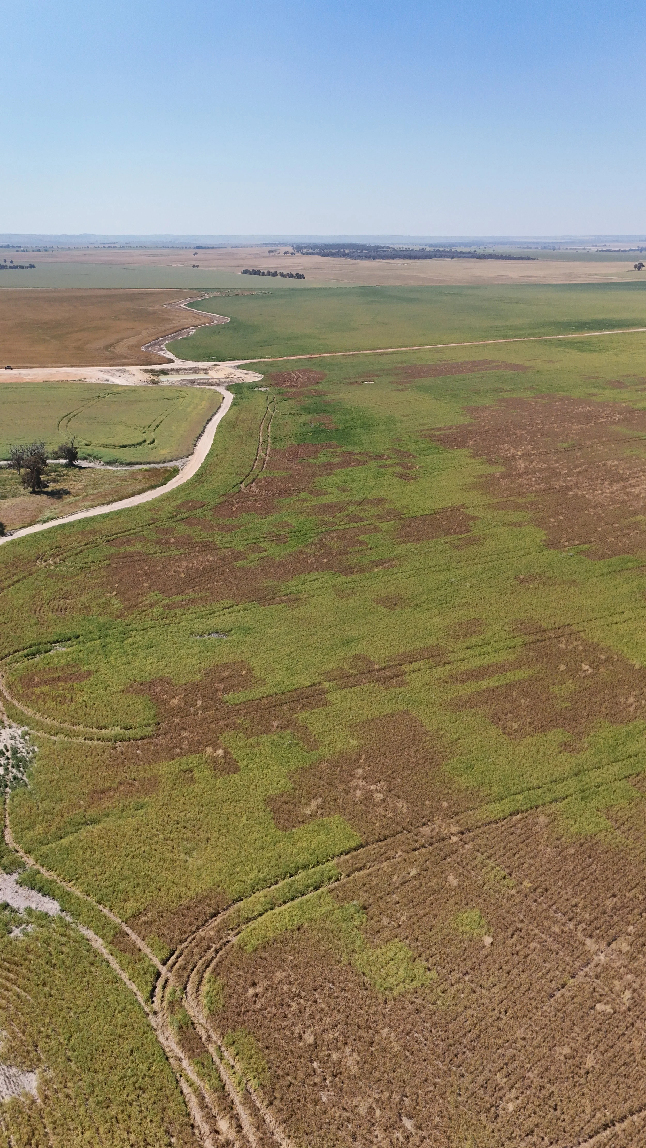
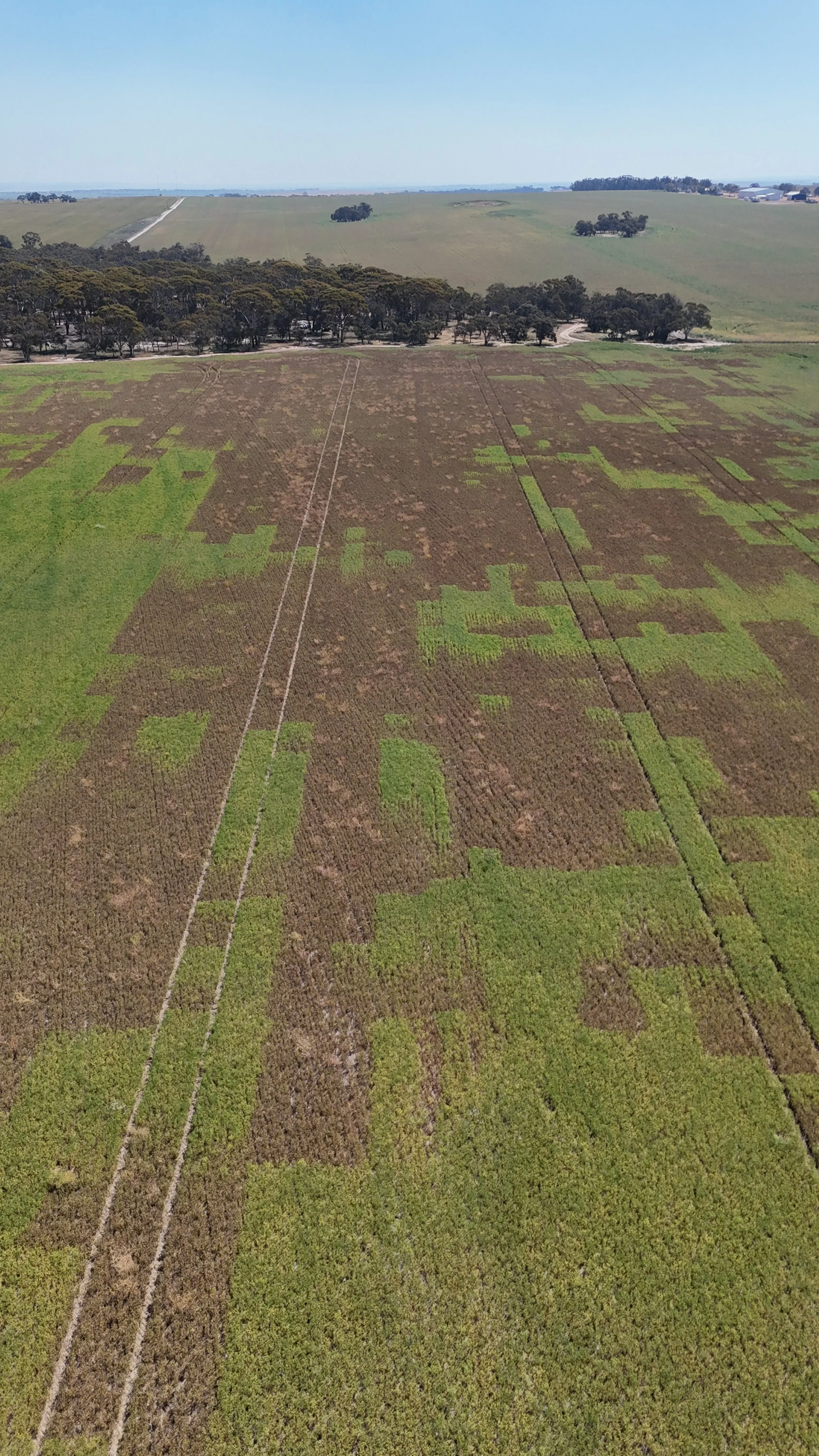
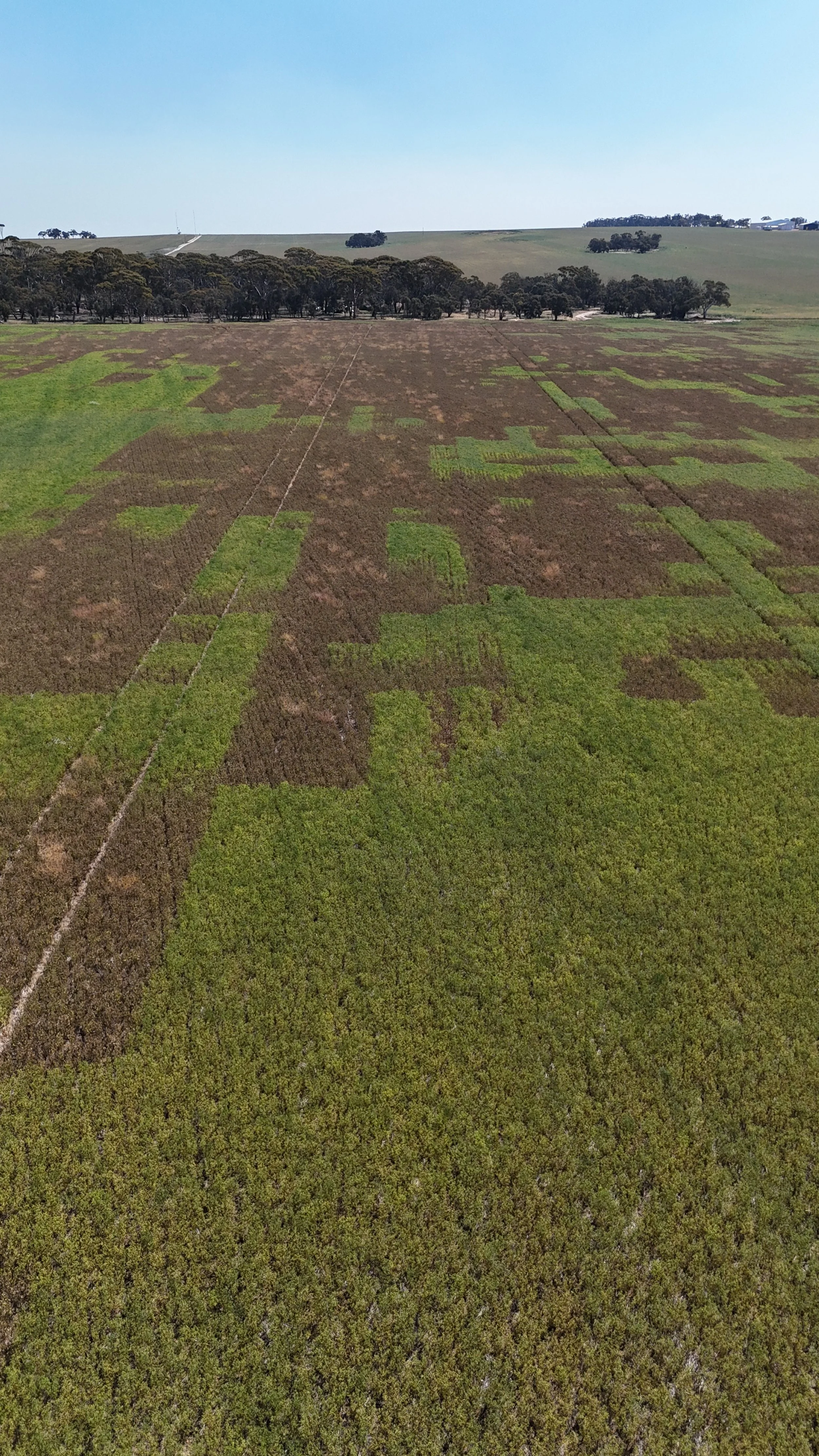
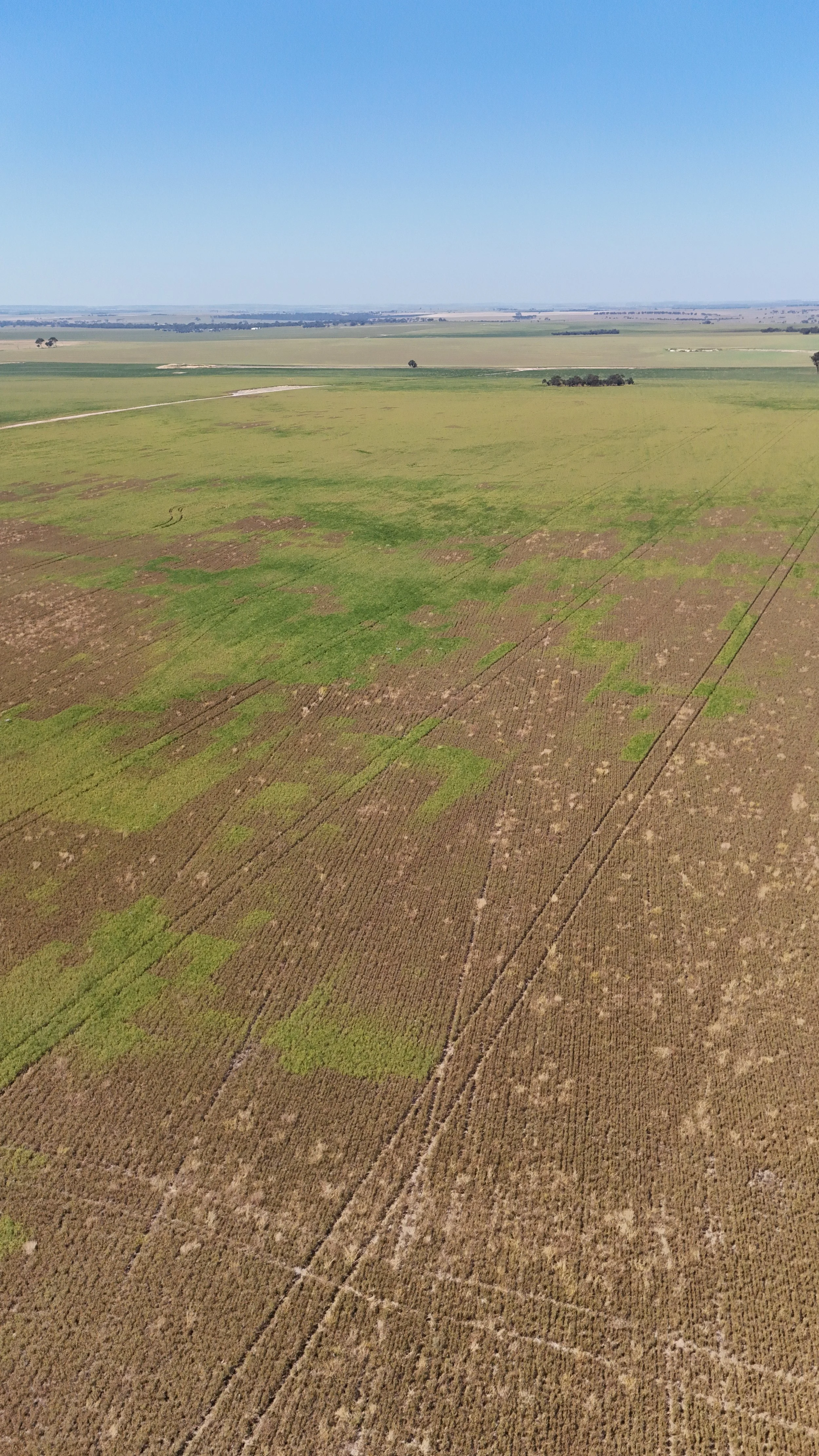
Using a high-resolution RGB camera, the drone captures ultra-detailed imagery of the paddock at a ground sampling distance (GSD) as fine as 1.0 cm per pixel. This level of precision makes it possible to clearly identify individual plants and even subtle differences in canopy structure. Once captured, AI software analyses the orthomosaic imagery, identifying differences in colour and contrast between crop and weed. At this stage, contrast remains the most effective detection method — particularly for flowering weeds in non-flowering crops. After processing, the data is converted into an orthomosaic map, which is then used to produce a prescription (Rx) map highlighting only the weed-infested areas. These Rx maps were uploaded directly into the John Deere Operations Center and imported into the farm’s 4060 sprayer, allowing the system to automatically target only the required patches. This same data can also be used in a drone sprayer, enabling precise, automated spot-spraying that treats weeds while leaving clean crop untouched.
In addition to this, similar approches can be used earlier in the season — on bare soil or stubble — to detect fresh germinations before canopy closure. Combined, the two methods give farmers a complete seasonal picture, from pre-seeding to in-crop control. This allows the sprayer operator to treat only the problem areas, drastically reducing chemical use without compromising control.
Real Numbers, Real Savings
In Bulyee, Ian’s drone from Drone Services WA mapped approximately 155 hectares of lupins. The data revealed that only 7% of the paddock contained significant weed pressure — around 10 hectares in total.
“We used 3 L/ha of glyphosate to knock down the radish,” Jacob said. “Without the drone, we would’ve had to spray 45 hectares and still risked operator error when manually switching the boomspray on and off. You could say we saved 35 hectares — roughly a $25,000 saving — for about $10/ha in mapping costs.”
The results demonstrate that drone mapping pays for itself in a single pass. Beyond the dollar savings, the operation also delivered agronomic benefits — less compaction, less overlap, and no unnecessary chemical load on healthy plants.

Drone Services WA: Experience in the Sky
The operation was conducted by Ian from Drone Services WA, who brings years of hands-on experience in agricultural drone applications across Western Australia. Drone Services WA specialises in weed mapping, targeted spraying, and data interpretation, using DJI’s industry-leading agricultural platforms. By using local operators like Drone Services WA, growers can access advanced mapping and spraying without the upfront investment or training required to own and operate the systems themselves — making it a low-risk entry point into precision agriculture.
Farming Smarter, Not Harder
For Jacob and Josh, the success of this project was more than just a one-off saving — it’s part of a broader shift toward data-driven decision-making on the farm.
“The weed burden that was there prior to these photos was extreme,” Jacob said. “We’ve only had this farm for three years, so we’re trying to get on top of the weeds. The accuracy and efficiency were spot on.”
Their next steps include investing in an in-house drone for early-season mapping and upgrading their boomspray to individual nozzle control, enabling full variable-rate application. This will tie drone data directly into their spray operations for even greater precision and efficiency.
Where This Technology Fits on WA Farms
Across the Wheatbelt, drone mapping is fast becoming a powerful new tool in the fight against herbicide resistance, rising chemical costs, and narrowing spray windows. Rather than replacing machinery, it complements existing equipment — providing accurate data that guides where and how to spray.
By knowing exactly which hectares need attention, farmers can:
✅ Cut herbicide costs by up to 80% in patchy paddocks
✅ Reduce soil compaction by keeping rigs out of clean areas
✅ Limit crop stress from unnecessary application
✅ Collect season-on-season weed data to identify persistent problem zones
When paired with modern booms and drone sprayers, this system effectively creates a digital spray plan for every paddock — reducing guesswork and boosting efficiency.
A Glimpse of the Future for WA Farmers
This project showcases how drone mapping and precision spraying are reshaping weed management across Western Australia. By adopting drone technology, growers can make data-backed decisions, reduce inputs, and improve overall paddock performance. With strong local support from Drone Services WA and NextGen AgTech, growers now have access to both professional services and industry-leading DJI drone systems — creating a seamless pathway from contract mapping to complete on-farm integration.
“It’s not just about saving money,” says Jonathan Chick from NextGen AgTech. “It’s about using data to make confident, sustainable farming decisions. Every drop of chemical counts — and with partners like Drone Services WA, we can deliver that precision where it matters most.”
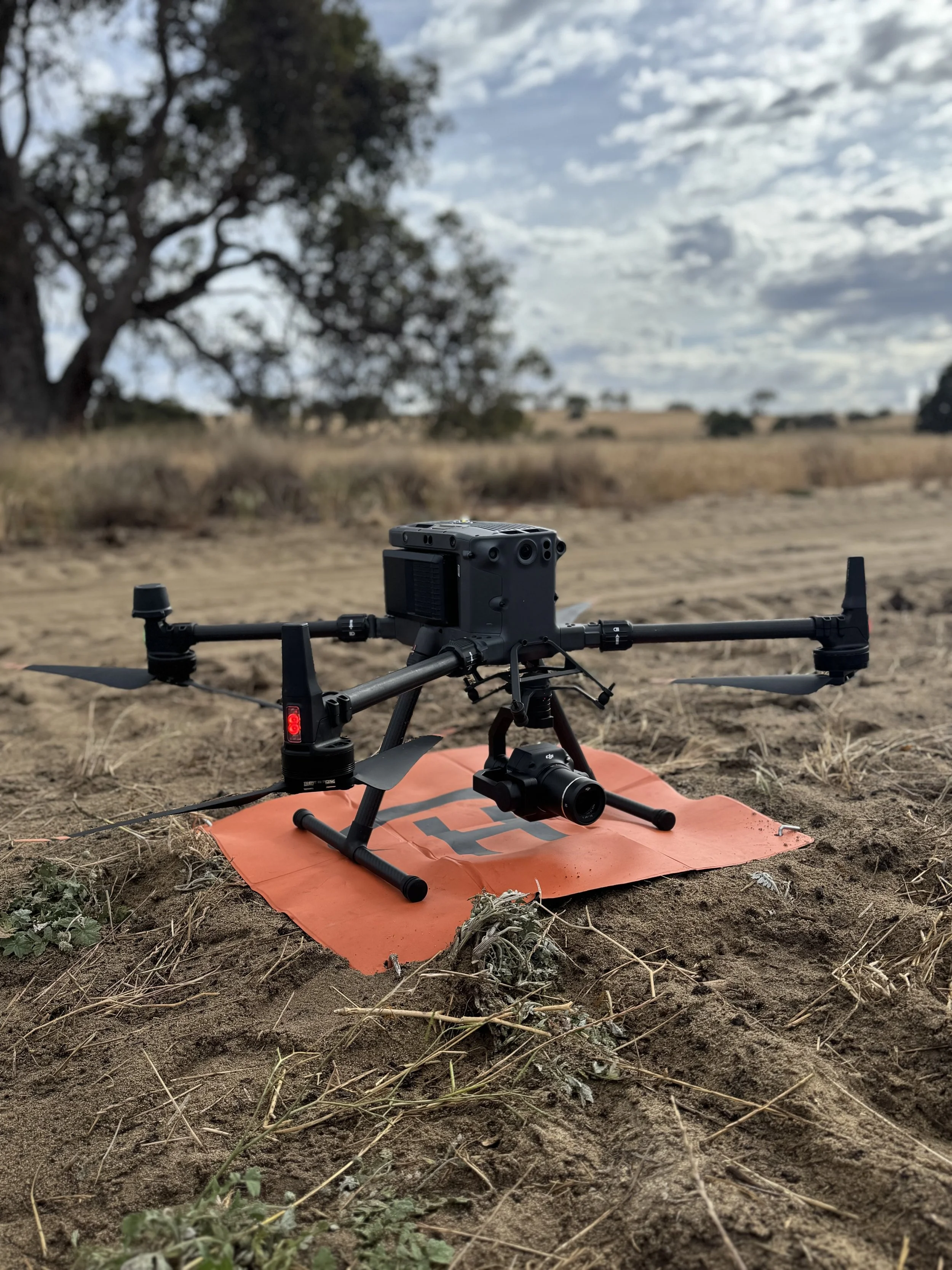
Image 6: DJI M350 With P1 Camera
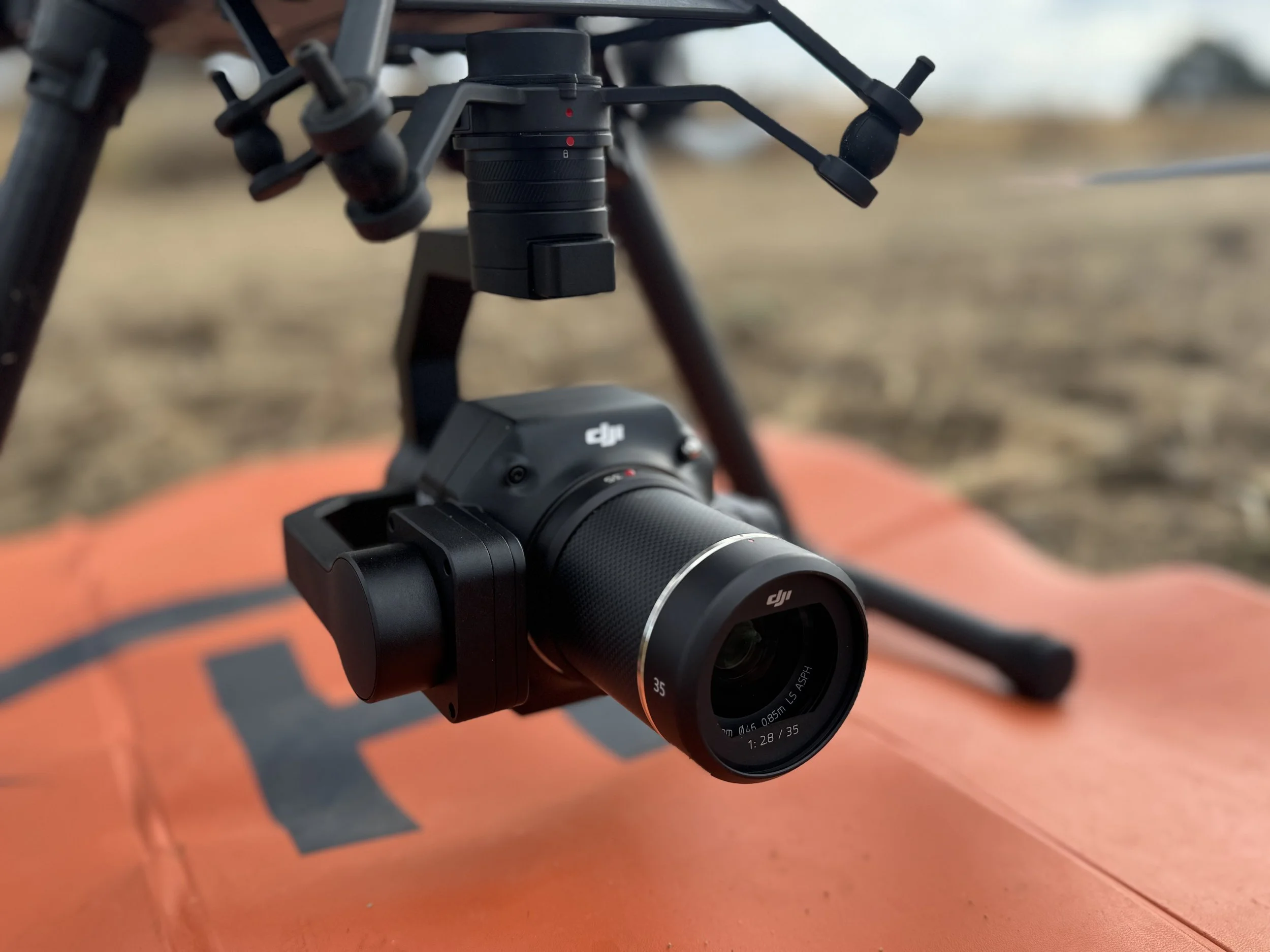
Image 7: DJI P1 Camera
About Drone Services WA & NextGen AgTech
Drone Services WA is a leading provider of professional drone operations for agriculture, mining, and environmental management across Western Australia. Founded and operated by Ian, the business has built a strong reputation for accurate, efficient, and practical aerial solutions that integrate seamlessly into real farming systems. With expertise in weed mapping, crop imaging, and data analysis, Drone Services WA bridges the gap between advanced drone technology and everyday farm application. Ian’s hands-on approach ensures every job — from small paddock surveys to large-scale spraying — is delivered with precision, reliability, and clear communication.
“Our goal is to deliver results that farmers can act on immediately,” Ian says. “We want drone data to be useful — not just impressive.”
By offering professional contract mapping services, Drone Services WA enables growers to access advanced drone technology without the upfront cost or complexity — providing a practical and affordable pathway to smarter farming.
NextGen AgTech, works to help growers take the next step: bringing drone technology in-house and making it part of daily operations.
As an authorised DJI Agriculture partner, NextGen AgTech supplies and supports the full range of DJI AGRAS and Enterprise drones, including the T25, T50, and T100 spray drones, Mavic 3M mapping systems, and associated training and service packages. The company provides complete sales, setup, training, maintenance, and contracting services for spraying, spreading, and mapping applications. Every drone supplied is fully operational, compliant, and backed by real-world experience from professionals who understand WA farming conditions. NextGen AgTech’s philosophy is simple — make technology work for the farmer, not the other way around. By combining agronomic understanding with technical know-how, the team ensures every solution fits seamlessly into existing farm practices.
“We don’t just sell drones — we help farmers get the best out of them,” says Jonathan Chick. “From setup to operation and long-term support, our goal is to help farmers use this technology confidently and profitably. When drones save time, chemical, and fuel — that’s when they become an essential tool, not just an accessory.”
With a strong focus on education, training, and after-sales support, NextGen AgTech empowers growers to adopt new technology with confidence — whether through on-farm demonstrations, tailored training sessions, or complete farm integration programs. Together, Drone Services WA and NextGen AgTech are helping growers across Western Australia move from blanket spraying to precision mapping, leading the shift toward smarter, data-driven, and sustainable agriculture.
To find out more about the uses of drones on your property, get in touch!
📞 NextGen AgTech – Jonathan Chick: 0419 254 517
📧 jonathan@nextgenagric.com | 💻 www.nextgenagric.com
📞 Drone Services WA – Ian: 0411 055 264
📧 ian@droneserviceswa.com.au | 💻 www.droneserviceswa.com.au